


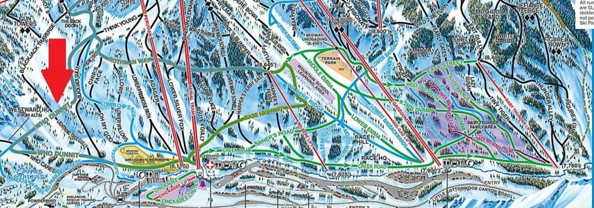
The View Condominiums are ski in/ski out to Snowbird – arguably the best ski in/ski out there is to Snowbird. You don’t need to be an expert skier but, you do need to be an intermediate skier to be able to take advantage of this access. So, how do you ski to Snowbird? The View is located at the very end of Blackjack Road. The trail to Snowbird starts at the end of this road and is called the Condo Bypass on the Snowbird trail map. The Condo Bypass is a short run that joins up with the bottom of Whodunnit. From there it is a short distance to Peruvian Express, The Snowbird Center and Tram or you can continue downhill over to the Gad Valley (Gadzoom, Mid-Gad, and the Wilbere lifts). So…basically, you walk out the door to The View, take a right and put on your skis. To ski back to The View, follow Middle Chips Run to the intersection with Think Young, and Whodunnit (signed as: peruvian entrance to blackjack). Make a right hand turn here. Continue to follow the wide open slope as it soon funnels down to a cat track, past a slow sign. Continue on the cat track following Condo Access trail, not dropping into Whodunnit. You have made your way back to Blackjack Rd, and The View Condominiums. Alternatively, for advanced and expert Skiers, ski any terrain in the Upper Peruvian Gulch, staying skiers right at the Backdoor/Blackjack traverse gate.
And how do you get to Alta? The Alta Resort Shuttle has a pick up spot right outside the door to the View Condominiums. This shuttle makes a continuous loop of the Bypass Road during daytime hours. The shuttle runs continuously during the day. It will typically take just a few minutes to get up to the Collins or Sunnyside base areas at Alta. After skiing, you can utilize this same shuttle to bring you back to the property or you can ski home from Alta via an off-piste advanced run. Check out our Aerial Overview Video for a visual reference on location.
Check out this aerial overview to help put some visual landmarks together: https://www.altachalets.com/explore-alta-snowbird/alta-snowbird-aerial-overview/
Special Notes: As with any of the runs at Alta and Snowbird, access is based on the current conditions. When looking at a trail map, Whodunnit is in the lower left corner.


